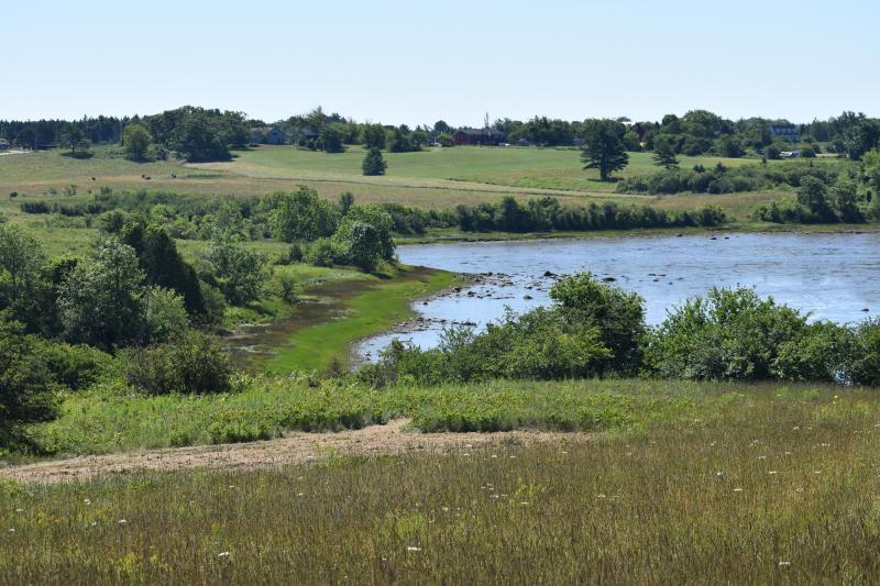
SOUTH THOMASTON – Explorers, walkers, naturalists and birders may one day find themselves on the ‘Bobolink Trail’ in South Thomaston, courtesy of the Georges River Land Trust. GRLT is proposing an easy walking path that would wind through 38 acres of meadow land and provide scenic overlooks to the mud flats below.
A parking lot, boardwalk through a patch of woods, information signs, and picnic pavilion are also being considered within the Riverview Hayfields Preserve.
At this time, the trail is still in concept stage. Any paths that exist are examples of what could be, though clam diggers already access the flats. GRLT plans to provide opportunities for public comment before they begin fundraising for the $75,000 project, which also includes staff salary and educational outreach.
The trail is a way for the organization to expand public access and to offset limited access of other lands relegated to conservation, private and public.
Because of its desire to work with the public, GRLT intends to allow leashed canines on the trails.
The field proposed for the trail, which GRLT has owned for two years, is known for the thousands of wings that migrate through from October to June, as well as the grassland birds.
“You can imagine, if you are in this cross-continental flight, you’re looking for a place to rest and have the most efficient use of that resting time,” said Annette Naegel, director of conservation for GRLT, “and then flying overhead and seeing what’s available in this small region.”
Bobolinks, which migrate around 12,000 miles and create their nests and families within the tall spring grass, take advantage of the area before haying is allowed after June 15.
Coyotes, moose, and falcon have also made appearances in the region, according to Naegel.
On Saturday, July 21, residents in South Thomaston gathered at the Finnish Congregational Church on Route 131 to learn about continued preservation efforts of the open farm lands south of the railroad tracks, as well as the trail.
“This region is considered the gateway to the peninsula,” said Naegel. “It is so breathtaking. The sun sets on the western side of the river, and when heading south in the evening, you just get magnificent views. It really is a breathtaking entrance to this part of Maine.”
Peter Duffy, of Union, agreed.
“After going over the railroad tracks, there before me is my favorite vista,” he said. “You look out the left side of the car and there are rolling green pastures and the Weskeag river, home to many migrating birds. On the right, more green pastures, cows contentedly munching on the summer grass and the majestic St. Georges' River rushing to the Atlantic ocean.”
Naegel believes that this region is the second most productive clam flat region in Maine, and that attribution comes from a five-town agreement to manage resources and incorporate conservation.
“The beauty of nature is that it works in balance,” she said. “We are a part of nature. We intersect, we interrupt, but we have to be very conscious, when we do, of how to offset that.”
Reach Sarah Thompson at news@penbaypilot.com


