Eva Murray: It’s about the water
")


If there's one thing they impressed upon us at the National Hurricane Center, it was to pay attention to the water. When there is a hurricane coming, everybody worries about the wind. Worry about the water.
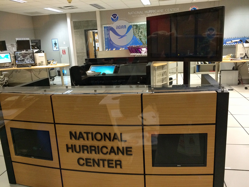
Last week, about 25 emergency management officials from northeastern states, with areas of responsibility ranging from the Chesapeake Bay region to Maine, gathered for a four-day training session at the National Hurricane Center in Miami, Fla. My position as local emergency management director for the micro-municipality known as Matinicus Isle Plantation would not likely require me to consult with politicians and direct my large office staff to implement a plan for the evacuation of this city — and sitting beside guys from New York City who had worked through the 2012 Superstorm Sandy was an entirely humbling experience in that respect — but bringing knowledge back to the area is never a bad thing. Also, the National Hurricane Center itself is pretty cool, if you are the right sort of nerd, and I suppose I am.
Our classwork included a fair bit of meteorology, some disaster planning exercises, a tour of the facility and tutorials on the specialized computer mapping programs available to emergency managers. As impressive as the computerized forecasting products are, with their multicolored maps and location-specific detail, it takes a combination of advanced science, lots and lots of observational input, a healthy respect for the pros and cons of statistics, and human beings with local knowledge to make decisions.
In short: there is still no way to tell exactly where a storm is going to be tomorrow, not to mention next week.
The National Hurricane Center and the National Weather Service have a couple of major messages they would like the public to understand and take seriously. First, people need to recognize that storm surge can be a very serious threat, and in some cases much more of a threat to lives and property than the high winds of a hurricane. Depending on the angle of impact, the size of the storm and the precise location of landfall with respect to the shape of the coast, a tropical cyclone can drive an immense amount of water up a river, harbor, bay or inlet, inundating neighborhoods shore-side and up-river. If you add freshwater flooding from heavy rain to the mix, the threat of significant damage and danger from water — regardless of the wind — is very real.
People should also keep in mind, as they watch the TV news reports or follow the weather on their computer, that the "cone" we see on hurricane forecast maps represents a two-thirds (67 percent) statistical probability of the location of the eye of the storm at a given time. That's all it means! It does not indicate that "outside of the cone is a safe zone," or that "inside of the cone is sure to be impacted," or anything about certainty or damage at all. Forecasting is largely a matter of statistics. The technology is improving, but the fact still remains that a small change in storm track can make a big difference in damage, and small changes in storm track cannot really be predicted.
We were taught the acronym SWIFT, referring to the main threats from hurricanes: Surge, Wind, Inland Flooding and Tornadoes," in order of what typically poses the greatest threat. Storm surge is often the biggest threat to the most people. Again, worry about the water.
Speaking of acronyms, here's one where we can safely assume that the acronym came first and the individual words were pieced in to fit: a useful and impressive National Hurricane Center computer mapping program for estimating inundation of land is called SLOSH: Sea, Lake and Overland Surges from Hurricanes." "Lake" in this case, basically means near-shore saltwater estuaries and places like Lake Pontchartrain; we aren't talking Chickawaukie Pond, often referred to locally as a lake.
There are many common misconceptions about how hurricane forecasting and preparedness works. Evacuation and other emergency response decisions are not made by the meteorologists. In fact, they cannot be made by the meteorologists. The National Hurricane Center cannot tell a mayor to move people out of a city; all they can do is provide a best-guess for the storm's movement based on science, statistical methods and experience. Predictions and forecasts are based on what is known about high and low pressure centers and other factors that cause changes in a storm track's direction, and a fair bit of math; there is simply no way to actually know with certainty just where a storm is going to go. More severe, better organized storms are easier to track, meaning a full-fledged hurricane is more likely to be accurately trackable than is a loosely-formed tropical storm far off in the Atlantic. This may give small comfort but it makes sense. Also, as much as we'd like to convince ourselves otherwise, previous storms are not scientifically predictive of the behavior of the next storm. Don't rely on, "This neighborhood was fine last year."
We talked a lot about Hurricane — and then Superstorm — Sandy. By the way, the word “superstorm” is not any sort of official meteorological category. The word was coined (I think somewhere in New Jersey) to deal with the lack of a serious-enough-sounding term once a storm is no longer technically a tropical cyclone. The weather guys use the term “extratropical" storm, but that doesn't adequately urge Grandma in Rockaway Beach to pack up her poodle and drive inland. Once Sandy was no longer officially a hurricane or a tropical cyclone, but its potential for destruction was still great, the question was: what should they call it?
If we learned anything from Sandy, it's that the storm doesn't really care whether or not it's technically called a hurricane.
The other big message for the general public will be no surprise: if you are supposed to evacuate, do it. The mapping now available to predict which areas may become dangerously flooded is pretty decent science. Sure, we won't see the worst-case scenario every time (thankfully!) but once you are surrounded by water, there's no getting out. If you are told that your home is in an area of likely inundation for this particular storm, skip the nonsense about flashlight batteries from the store, or beer for a hurricane party. Just hit the road.
That having been said, sometimes we on this island hear panicky but ill-informed advice from mainland friends, relatives and even authorities without maritime experience. "There's a storm coming! Get off the island!" They imagine a flat island where the seas could wash over the whole town. Such islands do exist but this is not one of them. Emergency management people are taught that proper evacuations are hopefully completed by time the tropical storm winds begin in a given area, and part of our training this week was on how to estimate that timing for one's own part of the world, using available computerized weather service products and the latest evacuation study data. Of course, large evacuations cannot always really be completed before the wind blows, but usually we're still talking about people driving inland in their cars — not crossing open ocean.
In the case of a place like Matinicus, this emergency manager, anyway, will absolutely not advise, recommend or organize an evacuation using lobster boats, ferries or little Cessnas once the wind is screeching. It would, as a rule, be much safer to stay put. A lot of people off-island don't know that, and to be sure, islanders would be cut off from any help, including medical care, but that weather-induced isolation happens to us every few weeks anyway, hurricane season or not. That's just island life. So unless we had something truly nightmarish like a simultaneous forest fire at the same time as the approaching storm, we are not likely to evacuate the entire island. Those who live near the shoreline would be well advised to go visit friends with homes in the interior of the island, and if necessary we could open our schoolhouse as an emergency shelter, and we may start up a few generators, and hopefully mariners have secured their boats, but anybody who is still here will ride it out. Once the storm is upon us, crossing the bay is unlikely to be the safest option.
I am not suggesting everybody everywhere have that same attitude.
Thankfully, most people in our area remain attentive to the weather. With a high percentage of commercial fishermen and others who work and play outdoors, at least a large portion of the residents of coastal Maine aren't going to be unaware of an approaching storm. If they need to haul their boat, check their mooring or change their work schedule, they generally will at least think about it. In some parts of the country, emergency managers cannot assume that everybody's paying attention. Consider the realities of a large city where many are helpless, perhaps speaking little or no English, without a vehicle or without any idea where to go. We're not in a bad place around here.
Speaking of watching the weather, I learned that the so-called European Model we sometimes hear about on the TV news is, in fact, a good hurricane prediction tool, as good as any and better than some, and very reputable. But here's the catch: the European Model is not a governmental entity. It is not Europe's version of the National Weather Service. It's a proprietary, commercial product, which must be purchased, and therefore not every set of predictions will include the European Model's reckoning. It also isn't perfect.
The Weather Channel, by the way, is also a commercial entity; it is not a branch of the National Weather Service. Not everybody seems to know that. It is the Weather Channel, and not the NWS, that names those winter storms. If you think calling a snowstorm Winter Storm Nemo was silly, don't blame the NWS. They only name tropical cyclones.
Our course was taught and sponsored by the National Hurricane Center, the Federal Emergency Management Agency and the Army Corps of Engineers — and, by the way, let me offer kudos and a word of appreciation to the entirely human, helpful and friendly people from FEMA who assisted with the course and the logistics. These folks did not represent the faceless, mind-numbing bureaucracy we sometimes think of as FEMA in the abstract. One good-natured FEMA staffer from Louisiana and New York made the offhand comment, "Crunch a few numbers, save a few lives..." I'll keep that in mind.
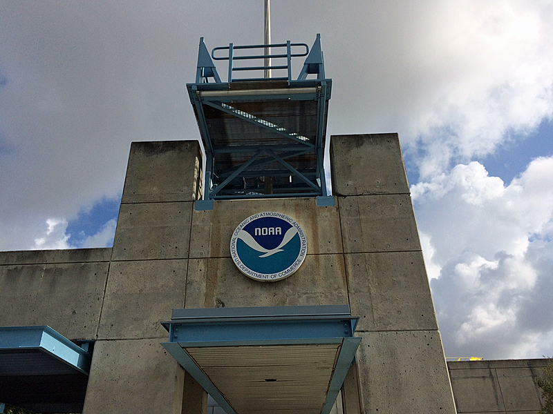
During the tour of the National Hurricane Center facility in its concrete-within-concrete fortress of a building, we got to meet a couple of the Hurricane Hunters, the guys who fly airplanes into storms in the name of science. The fellow giving us the talk said he had been obligated to retire recently at age 65, but you could tell from his child-like enthusiasm that he loved his job, loved flying into the worst turbulence you can imagine. (He said he never got sick, either.) The National Oceanic and Atmospheric Administration (of which the National Hurricane Center and the National Weather Service are parts) together with U.S. Air Force 53rd Weather Reconnaissance Squadron regularly fly into hurricanes gathering data and dropping weather instruments, which send back measurements. Lots of information about the Hurricane Hunters can be found online, but I'll admit, I felt it was an honor to meet a few of the people who fly those planes.
Somebody else in the class asked about "ride-alongs" with the Hurricane Hunters, because during the tour of the National Hurricane Center, one of the old pilots laughed about how they'd occasionally end up taking people from the media. Somebody assured us, "Oh, well, that's really hard, you'd have to get security clearance, that takes a while, with a federal background check, and you need that overboard upside-down escape from aircraft class in the water, so it probably would be impossible..."
Hah; done and done. If I ever got the chance, I'd take that ride in a minute.
*This year’s Hurricane Preparedness Week begins May 15.
 Eva Murray lives on Matinicus
More Industrial Arts
• Eva Murray: In defiance of mud season - tips for the inspired homeowner
• Plesiosynchronicity, and a snowy day
• A day of planning and practicing in preparation for major storms (posted March 10, 2016)
• Time to take down the (island) Christmas tree (posted March 3, 2016)
• Snow Day on Matinicus (posted Feb. 14, 2016)
• Going to Rockland for pie (and beer and art glass and ukuleles...) (posted Feb. 3, 2016)
• Eva Murray: Pencil to paper (posted Jan. 21, 2016)
• A new year, a new winter (posted Dec. 31, 2015)
• ‘A tiny, happy place’ (posted Dec. 14, 2015)
• Metal artist Blair Clement brings wave-washed junk to life (posted Sept. 20, 2015)
• Maine veterans and a most sentimental biker (posted June 1, 2015)
• Wild Island Child (posted April 8, 2015)
• Last holdouts of offshore outpost finally accept reality (posted April 1, 2015)
• Truck on boat (posted March 16, 2015)
• Public works (posted Feb. 25, 2015)
• A constant struggle (posted Feb. 14, 2015)
• Pie Hero, Pie Villain (posted Jan. 29, 2015)
• Safely out to sea (posted Jan. 27, 2015)
• Je suis (posted Jan. 13, 2015)
• Making merry on Matinicus, with only a few (posted Dec. 25, 2014)
• The smallest emergency medical service around (posted Sept. 29, 2014)
• Islanders host 'Man Overboard!' discussion, rescue demonstrations (posted Sept. 8, 2014)
• Logistics (posted July 31, 2014)
• Black Hawks over Criehaven (posted July 16, 2014)
• On a sunny Saturday, when the steel band came to Matinicus (posted June 6, 2014)
• The last day of winter (posted April 16, 2014)
• Puppies, basketball champs not injured by explosive five-bulldozer wreck, dump fire, and zoning board (posted March 13, 2014)
• In a good old hardware store (in memory of Everett Crabtree) (posted Feb. 28, 2014)
• What is it like to be one of Maine's Search and Rescue volunteers? (posted Feb. 9, 2014)
• Arts and hobbies (posted Jan. 31, 2014)
• Santa Claus and the yard sales - why I own more monkey wrenches than you do (posted Jan. 15, 2014)
• Quiet on this last day of the year (Dec. 31, 2013)
• A one-room school Christmas (posted Dec. 21, 2013)
• Here's wishing us all a little rebellion in this happy season (posted Dec. 12, 2013)
• Roadside assistance (posted Nov. 27, 2013)
• On the many kinds of emergency responders (posted Nov. 18, 2013)
• (In defense of...) Breakfast for supper (posted Oct. 22, 2013)
• Fish Factory (posted Sept. 9, 2013)
• 350 dot Rockland... and many ruminations on small efforts (posted Aug. 30, 2013)
• Trains and planes and heroes (posted July 15, 2013)
• Joining the community of artists (posted July 4, 2013)
• Worth every penny (posted July 27, 2013)
• It's about showing up. Some thoughts on EMS Week (posted May 27, 2013)
• Ethanol, gasoline, and public safety (posted April 17, 2013)
• A system that makes it hard on people who want to do the right thing (part 2) (posted March 29, 2013)
• A system that makes it hard on people who want to do the right thing (part 1) (posted March 21, 2013)
• 'It's important' (posted Jan. 18, 2013)
• Tree crew (posted Dec. 28, 2012)
• Light the candles (posted Dec. 13, 2012)
• Firewood (posted Dec. 2, 2012)
• Missing man formation (posted Oct. 18, 2012)
• In the middle of the bay (posted Oct. 3, 2012)